THE CONFERENCE BEGINS IN —


 VENUE
VENUE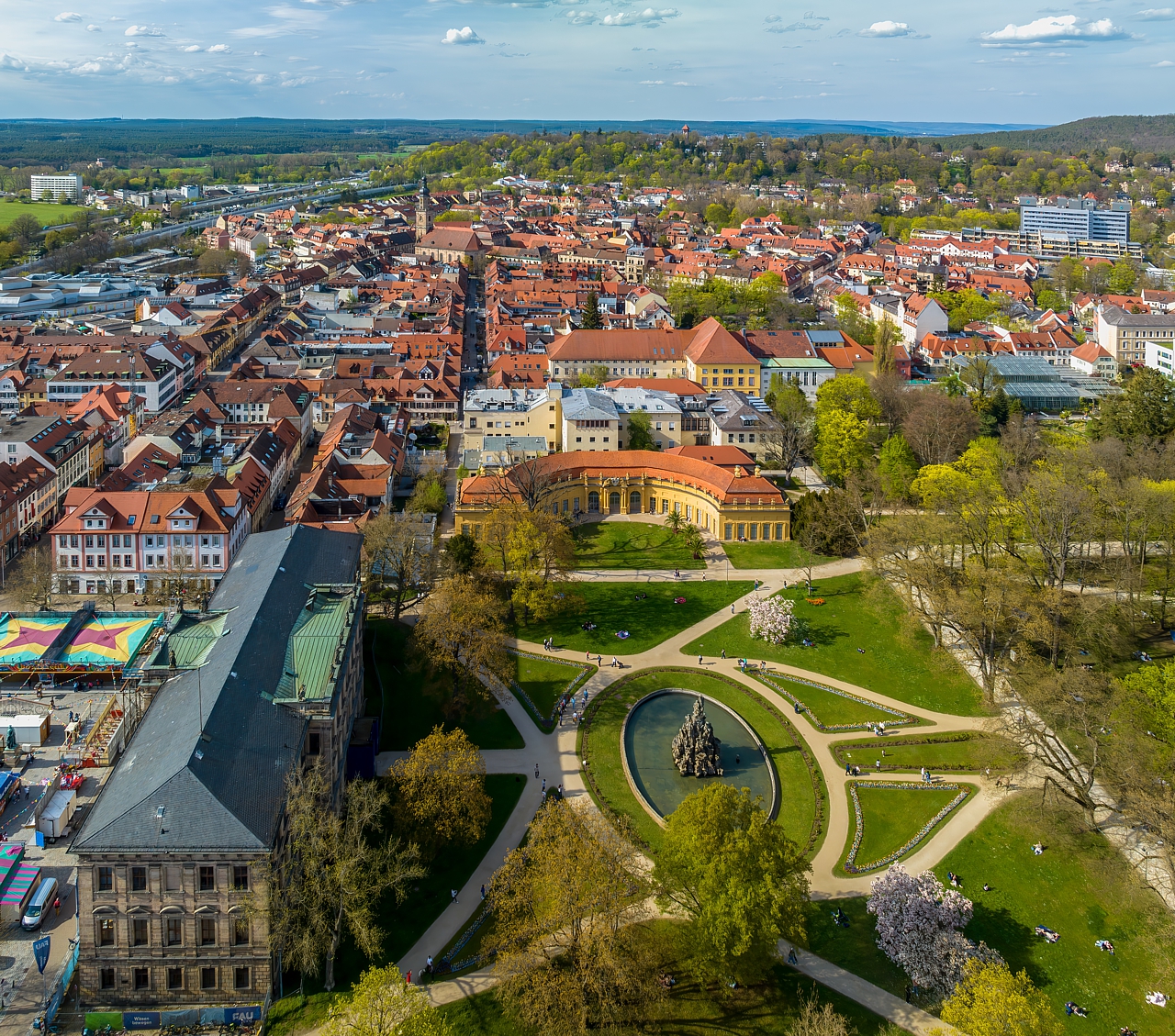
Castle and castle garden in Erlangen. Aerial view.
Photo © Reinhold Möller, 2023
The city of Erlangen is situated in the Bavarian region known as Middle Franconia.
More detailed information about the city will be published here as soon as they are available.
There are many sights worth seeing ;) We will successively publish the information about interesting sights in the vicinity of the conference venue here soon.
The city of Erlangen is located right next to the second-largest city in the German federal state of Bavaria, Nürnberg (or Nuremberg in English). This means that it is very easy to get there. Nuremberg has its own international airport (NUE), it lies on the junction of several motorways (namely A3, A6, A9, and A73) and several nationwide railroads. Thus, the city is easily accessible using both individual and public means of transport.
Erlangen is situated 175 km (109 mi) south-eastwards from Frankfurt , 170 km (106 mi) northwards from the Bavarian capital Munich , and 250 km (155 mi) from the Czech capital Prague . The closest international airport is located right in the middle between Erlangen and the neighbouring city of Nuremberg, the closest large international airport is the Franz Josef Strauß Airport München , which is 148 km (92 mi) away and one can get from there to Erlangen very easily within about two hours by public transport (buses/trains) or by car.
Erlangen itself lies on a main corridor railway and the neighbouring Nürnberg is an important railroad junction and, therefore, there are many trains from various directions coming to the area. There are numerous trains throughout the whole day from both München and Frankfurt where two large international airports are located.
You can use e.g. the Deutsche Bahn web application https://int.bahn.de/en to find a suitable connection for you.
The main railway station in Erlangen is located very conveniently close to the conference venue (about 0.5 km / 0.3 mi). The public transport in the city is procured by the (will be added later). To find a connection, you may use (will be added later).
The city has a fast motorway connection north-westwards to Frankfurt via the motorway A3/E41, and north-eastwards to the Czech capital Prague (Praha) via the motorway A6 → D5/E50. You can also reach it via the motorway A9/E45 from München (going northwards) or from Leipzig and Berlin (going southwards).
For other road directions, consult a map with route planning capabilities.
d.hip – Digital Health Innovation Platform
Henkestraße 127/128
D-91052 Erlangen
Germany
GPS: 49°35'38.437"N, 11°01'19.277"E
Phone: +49 176 2433 5671 (Project Management)
E-mail: tobias.zobel@d-hip.de
Website: https://www.medical-valley-emn.de/d-hip/
